 I just got back from a three-day trip to Marin County to finalize all the details of the Rough Riders Rally, including riding all three of the suggested ride routes with my Garmin 310xt to create the maps, elevation profiles and such. Part One of this blog post describes the suggested Friday ride for the Rally and Part Two describes the suggested Saturday ride. Now here's info about the suggested Sunday ride, briefly (I neglected to bring my camera, so I shot two photos with my phone and re-used two shots of the Saturday route which overlaps this one for a few miles).
This is the classic ride up Railroad Grade from Mill Valley to the top of Mt. Tam, also known as East Peak. No visit to Marin County is complete without this ride. The return is mainly via paved road, after returning to the West Point Inn on Railroad Grade (although several options exist for the descent from Mt. Tam to Mill Valley). This return utilizes a few miles of dirt from the Rally's Saturday ride, and some paved miles on the way back into Mill Valley from the Rally's Friday ride, however this takes a "locals only" route back to The Depot at the very end of the ride.
The final "occasion" of the Rough Riders Rally will be social time at The Depot in downtown Mill Valley, so we all need to end up back there around the same time. Total distance is 20 miles with 2800 feet of elevation gain.
Here's a map and a few photos from this recon ride, but be sure to check out the Garmin Connect page to interact with the map, elevation profile, and more! You can also see these images and more on our website.


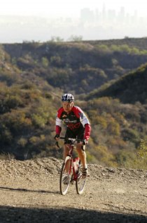
 Above: Ascending Railroad Grade from Mill Valley up Mt. Tam.
 Above: The view of the San Francisco Bay from West Point Inn, most of the way to the summit of Mt. Tam.
 Above: The view from the summit (East Peak) of Mt. Tam, looking south.
 Above: There's a lot to see from up there, so this sign helps you figure it all out.
Below are links to all the route details for all three suggested routes. If this information and these photos don't make you realize that the 2010 Rough Riders Rally is Not To Be Missed, than I don't know what does!
Links:
1.7 mile route from Acqua Hotel to Tam Bikes
Friday ride at Rally: Alpine Dam Loop (Garmin)
Friday ride at Rally: Alpine Dam Loop (Slideshow)
Saturday ride at Rally: Marin Headlands (Garmin)
Saturday ride at Rally: Marin Headlands (Slideshow)
Sunday ride at Rally: Railroad Grade up Mt. Tam (Garmin)
Sunday ride at Rally: Railroad Grade up Mt. Tam (Slideshow)
Rough Riders Rally routes index
Rough Riders Rally home and registration


