Showing posts with label Marin County. Show all posts

Tuesday, June 29, 2010

Rough Riders Rally; Final Recon of all Routes, Part 3

I just got back from a three-day trip to Marin County to finalize all the details of the Rough Riders Rally, including riding all three of the suggested ride routes with my Garmin 310xt to create the maps, elevation profiles and such. Part One of this blog post describes the suggested Friday ride for the Rally and Part Two describes the suggested Saturday ride. Now here's info about the suggested Sunday ride, briefly (I neglected to bring my camera, so I shot two photos with my phone and re-used two shots of the Saturday route which overlaps this one for a few miles).

This is the classic ride up Railroad Grade from Mill Valley to the top of Mt. Tam, also known as East Peak. No visit to Marin County is complete without this ride. The return is mainly via paved road, after returning to the West Point Inn on Railroad Grade (although several options exist for the descent from Mt. Tam to Mill Valley). This return utilizes a few miles of dirt from the Rally's Saturday ride, and some paved miles on the way back into Mill Valley from the Rally's Friday ride, however this takes a "locals only" route back to The Depot at the very end of the ride.

The final "occasion" of the Rough Riders Rally will be social time at The Depot in downtown Mill Valley, so we all need to end up back there around the same time. Total distance is 20 miles with 2800 feet of elevation gain.


Here's a map and a few photos from this recon ride, but be sure to check out the Garmin Connect page to interact with the map, elevation profile, and more! You can also see these images and more on our website.
Above: Ascending Railroad Grade from Mill Valley up Mt. Tam.
Above: The view of the San Francisco Bay from West Point Inn, most of the way to the summit of Mt. Tam.
Above: The view from the summit (East Peak) of Mt. Tam, looking south.
Above: There's a lot to see from up there, so this sign helps you figure it all out.

Below are links to all the route details for all three suggested routes. If this information and these photos don't make you realize that the 2010 Rough Riders Rally is Not To Be Missed, than I don't know what does!

Links:
1.7 mile route from Acqua Hotel to Tam Bikes
Friday ride at Rally: Alpine Dam Loop (Garmin)
Friday ride at Rally: Alpine Dam Loop (Slideshow)
Saturday ride at Rally: Marin Headlands (Garmin)
Saturday ride at Rally: Marin Headlands (Slideshow)
Sunday ride at Rally: Railroad Grade up Mt. Tam (Garmin)
Sunday ride at Rally: Railroad Grade up Mt. Tam (Slideshow)
Rough Riders Rally routes index
Rough Riders Rally home and registration

We hope to see you at the Rough Riders Rally! Please join in the fun!

Rough Riders Rally; Final Recon of all Routes, Part 2

Above: My Rivendell Roadeo at the picnic area along Railroad Grade at the West Point Inn.


I just got back from a three-day trip to Marin County to finalize all the details of the Rough Riders Rally, including riding all three of the suggested ride routes with my Garmin 310xt to create the map, elevation profile and such. Part one of this blog post describes the Friday ride for the Rally. Now here's info about the Saturday ride!

On Saturday, June 26 of my recon visit I rode the route which is suggested for Saturday of the Rough Riders Rally. It is one TOUGH route. It is "only" 36.5 miles, however these are 36 and a half of the most beautiful miles one could ever ride, plus there is a total elevation gain of 5,764 feet. Most century cycling events have less climbing than that!

The route features single track, double track, fire road, gravel road, abandoned paved road, and newly paved road. Some consider this "mountain bike territory," but this route is 99% rideable by an accomplished Rough Rider on a road bike with 32mm cyclocross tyres (or on a cyclocross bike), and perhaps 90-95% rideable on a road bike with 28mm road tyres (some of the long downhill parts might make some people nervous on skinny road tyres).

This time, I rode my Rivendell Roadeo with a low gear of 38 front x 28 rear, shod with Ritchey Speedmax Cross tyres, which have a small amount of tread on them.

Here's a map and a dozen photos from this recon ride, but be sure to check out the Garmin Connect page to interact with the map, elevation profile, and more!
(All images below are in order as if riding the route.)

Also, be sure to check out the full slideshow of this route (from my previous recon rides).

Finally, I have a Pdf of the route sheet for this ride online here (use at your own risk).
Above: I stopped because this couple had a rare Otis Guy mountain tandem, then they pointed out the lovely flowers, and then I learned that the male half of this dynamic duo is Owen Mulholland, the legendary cycling journalist and author! What a treat to meet them both! I invited them to attend the RR Rally and I hope they do! (They had slick tyres on their tandem, by the way!)
Above: Our route crosses the world-famous Dipsea Trail (from Mill Valley to Stinson Beach) and I encountered the Double Dipsea race during my ride!
Above: We exit the Zen Center's Green Gulch Farm via this gate. Next up is some seriously steep single track with a few gnarly 180 degree switchbacks.
Above: During a rare nearly flat part of the Middle Green Gulch Trail. On the steep parts, you do not want to dab or you will have a difficult time getting restarted!
Above: Self-portrait with Mt. Tam behind, at the intersection of the top of Middle Green Gulch Trail and Coyote Ridge Trail.) The camera's POV is north by northwest.
Above: Cruising along Muir Beach at Fort Cronkhite.
Above: I decided to add on some more miles and climbing to this route, in part so that Rough Riders Rally participants can see and photograph the quintessential view of the Golden Gate Bridge. Alas, the world-famous SF summer fog blocked the view when I was there, but hopefully we'll get that view at the Rally! (Intersection of McCullough and Conzulman Roads. Conzulman itself is closed for the summer due to major road work, so we descend back from here on Coastal Trail.)
Above: Almost to the top of the very last climb of the day, atop Bobcat Trail just before it connects into Marincello.
Above: At the end of the ride, on the bridge along the bike path which connects the Acqua Hotel to downtown Mill Valley, with Mt. Tam behind. Good work, Rivendell!

Below are links to all the route details for all three of the suggested routes. If this information and these photos don't make you realize that the 2010 Rough Riders Rally is Not To Be Missed, than I don't know what does!


Links:
1.7 mile route from Acqua Hotel to Tam Bikes
Friday ride at Rally: Alpine Dam Loop (Garmin)
Friday ride at Rally: Alpine Dam Loop (Slideshow)
Saturday ride at Rally: Marin Headlands (Garmin)
Saturday ride at Rally: Marin Headlands (Slideshow)
Sunday ride at Rally: Railroad Grade up Mt. Tam (Garmin)
Sunday ride at Rally: Railroad Grade up Mt. Tam (Slideshow)
Rough Riders Rally routes index
Rough Riders Rally home and registration

Rough Riders Rally; Final Recon of all Routes, Part 1

Above: the view looking west from my room at the Acqua Hotel, before my ride: Mt. Tam and Mill Valley!

I just got back from a three-day trip to Marin County to finalize all the details of the Rough Riders Rally, including riding all three of the suggested ride routes with my Garmin 310xt to create the map, elevation profile and such. It's just 1.7 miles from our host hotel to the start / finish of each of the three rides. Acqua Hotel is not only perfectly located, it's also a lovely hotel with a fantastic breakfast buffet. Though it's located right off the 101, it's absolutely quiet. The view of Mt. Tam is to die for, too! I rolled into town Friday, took a photo from my room, got on my Rivendell Roadeo and hit the road at nearly 5pm. Thank goodness for long summer days!

My route Friday was the suggested route for Friday afternoon at the Rally:
On the map you'll notice a little out-and-back by Ross (1.6 miles total). That ended up being a mistake as this was intended to be primarily a road ride with one nice trail section past Phoenix Lake, Lake Lagunitas, and Bon Tempe Lake. From Ross I was intending to catch a trail and cut across to the upper part of the route, where it says Meadow Country Club, however the intended trail was closed and will be until November due to some type of public works. (I wish there were some way to delete that dogleg from this route map, but I don't think so.) Therefore this whole route will be a paved ride. It's a fantastic ride, though, truly one of the best rides anywhere in the world. It's only 31 miles, not counting the dogleg, though it took me almost three hours and might take some people four hours because of the 3500 feet of elevation gain and the million-and-one places to stop to enjoy the view and take photos. I think it's a really good Friday afternoon / arrival day warm-up route for the Rally, plus it is THE classic local road ride for this area.

Here's a map and some photos, but be sure to check out the Garmin Connect page to interact with the map, elevation profile, and more! (All images below are in order as if riding the route.) Also, be sure to check out the full slideshow of this route.
At the bottom of this post are links to all the route details for all three of the suggested routes. If this information and these photos don't make you realize that the 2010 Rough Riders Rally is Not To Be Missed, then I don't know what does!
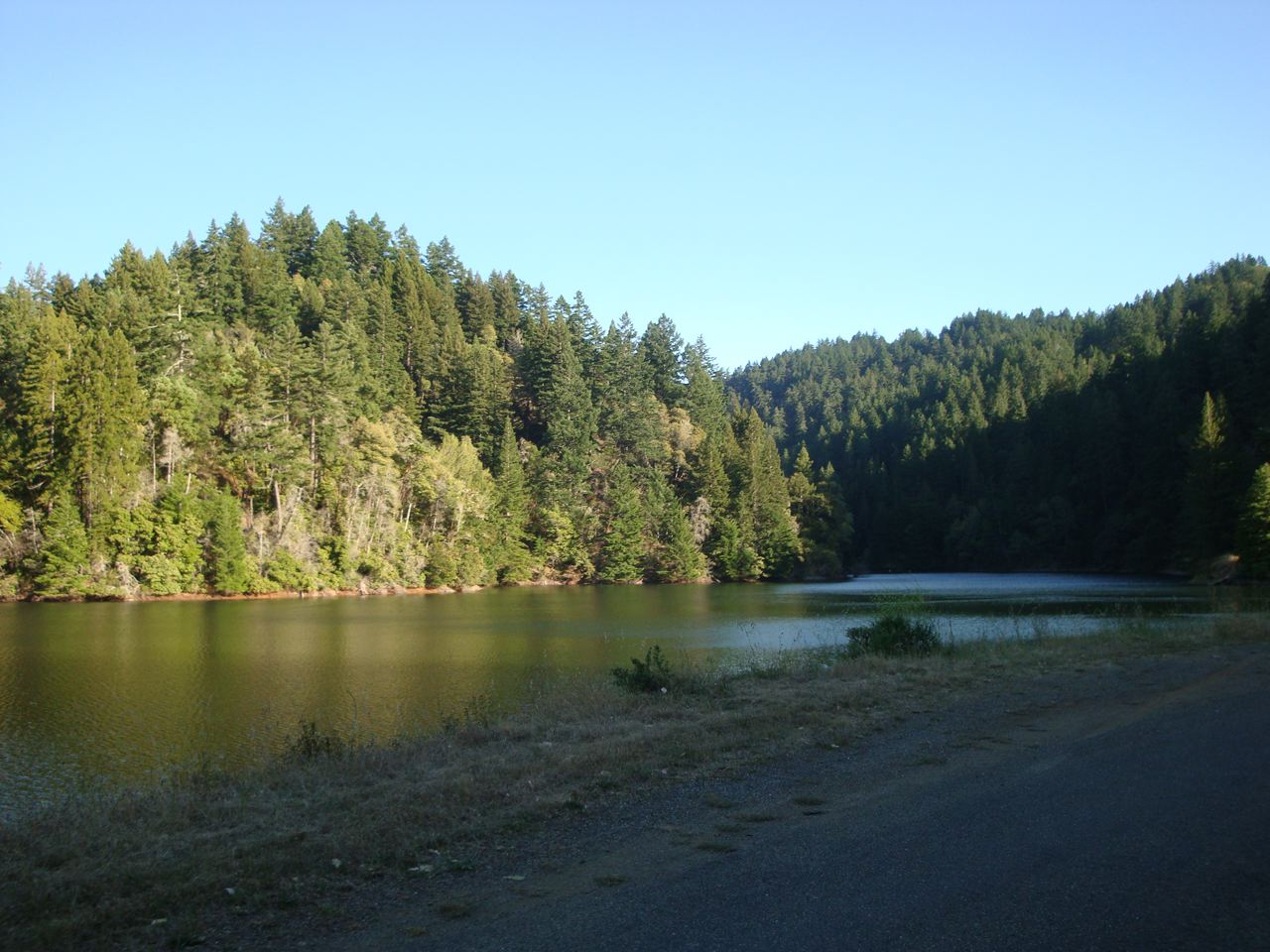
Above: Alpine Reservoir
Above: Late afternoon sun as I cross the Alpine Dam.
Above: at the top of the climb from Alpine Dam, left turn on Ridgecrest Blvd.
Above: Just a bit down Ridgecrest Blvd. The trees provide a lovely setting at any time of day.
Above: this is one famous road, not only for cycling, but also for car commercials. Thankfully, the traffic is light and the views are mind-boggling: southbound on Ridgecrest Blvd.Above: self-portrait heading along the upward rolling ribbon of road, with the Pacific Ocean off to my right.Above: that's Stinson Beach below me, shot while pedaling (like most of my photos).
Above: a quick self-portrait while stopped near the start of the descent to Panoramic Hwy. That's the San Francisco Bay off in the background.
Above: That's the San Francisco Bay off in the background; you can also see some of the descent to Panoramic Hwy. Time to fly back down to Mill Valley!
Above: Back at the Acqua Hotel before sunset!
Links:
1.7 mile route from Acqua Hotel to Tam Bikes

Friday ride at Rally: Alpine Dam Loop (Garmin)
Friday ride at Rally: Alpine Dam Loop (Slideshow)
Saturday ride at Rally: Marin Headlands (Garmin)
Saturday ride at Rally: Marin Headlands (Slideshow)
Sunday ride at Rally: Railroad Grade up Mt. Tam (Garmin)
Sunday ride at Rally: Railroad Grade up Mt. Tam (Slideshow)
Rough Riders Rally routes index
Rough Riders Rally home and registration

Sunday, January 10, 2010

Rough Riders Rally Roster, including Special Guest Charlie Kelly

Above: Charlie Kelly, co-creator of the sport of mountain biking and a Special Guest of the Rough Riders Rally, as seen racing Repack in 1976.

With registration just announced for the July 23-25, 2010 Rough Riders Rally, we've already gotten some great registrants. We'll post an ongoing roster on our website here. This includes name, age, city, state, gender, plus bike details, blog/website link, and "internet nickname," as applicable. We're very excited to share this special experience with such a great group of riders!

Of special note: Charlie Kelley, co-creator of the sport of mountain biking, will be attending! Charlie was partners with Gary Fisher in the the first "Mountain Bikes" company (with the frames made by Tom Ritchey). Charlie was also first mountain bike race promoter (creator of the infamous Repack Downhill). He was also the first mountain bike magazine publisher (Fat Tyre Flyer). Charlie and Chris Kostman first met at the Iditabike in Alaska in 1988.

Friday, January 8, 2010

Rough Riders Rally: Registration Now Open!


FOR IMMEDIATE RELEASE: PLEASE DISTRIBUTE ASAP


Rough Riders Rally is AdventureCORPS' new multi-surface cycling festival based in Marin County which celebrates the "Any Bike, Anywhere" ethos. The first event of its kind, the Rally includes three optional days of world-class cycling on trails, fire roads, and pavement, a display of participants’ bikes, dinners, and a live webcast.

MILL VALLEY, CA - AdventureCORPS, Inc. an athlete-run firm producing and promoting ultra-endurance and extreme sports events, lifestyle, and media, is pleased to announce the inaugural Rough Riders Rally, a multi-surface cycling festival based in Marin County on July 23-25, 2010 which celebrates the "Any Bike, Anywhere" ethos.

Rough Riding is not defined by the type of bicycle or type of riding surface. Rough Riding is a state of mind, a riding style with limitless freedom and an all-pervasive sense of adventure. The Rough Riders slogan is "Any Bike, Anywhere" and the general idea is to use as little technology as possible while traversing a variety of riding surfaces and terrains. Hence, one of the Rough Riders' mantras is "technique beats technology." For some Rough Riders, that means riding a "road bike" with 25mm tyres on "mountain bike trails." For others, it means tackling any and all surfaces while riding a cyclocross bike, an old-school mountain bike, a 70s or 80s era road bike retrofitted with 650B wheels, a classic touring bike, or a world tour-ready 29er rig. The current bicycle industry, from major manufacturers to boutique frame builders, is also beginning to address this niche market, creating bicycles, or even lines of bicycles, under such monikers as "All Road Bikes," "All-Rounders," and "Adventure Bikes."

Regardless of bicycle choice, the goal of Rough Riding is to tackle any and all possible combinations of trails, fire roads, gravel roads, paved roads, singletrack, and any other possible riding surface - all within one ride, on just one bike. Perhaps the greatest beauty of Rough Riding is that any possible ride route can be created and enjoyed: Rough Riders do not choose between "road biking" and "mountain biking" and subsequently let the bicycle determine the route and terrain of any given ride. Instead, creative, "first ascent-style" rides can be strung together in one epic route which involves all manner of riding surfaces, sights, sounds, and scenes. The Rough Riding goal, perhaps? To see it all and do it all, to truly have an adventure.

The Rough Riders Rally will include a suggested Friday afternoon ride, followed by a pizza party catered by Stefano's Solar-Powered Pizza and hosted at Tam Bikes in Mill Valley. Saturday will be the big day: a suggested six hour ride in spectacular terrain. Later that afternoon the bikes will be assembled for a bike show. At the Saturday night Rough Riders Annual Shindig, all the bikes will be on display and a tasty dinner will be catered by Punjabi Burrito. It will be a fantastic, fun evening of story-swapping and camaraderie. Sunday morning, Rally participants are encouraged to ride Railroad Grade to the summit of Mt. Tam, then return to Mill Valley for a social hour or two at The Depot Café, before departing town.

The Rough Riders Rally will be based in Mill Valley, CA in Marin County, the birthplace of mountain biking. Marin County offers truly superb cycling, with fantastic views of the San Francisco Bay, Alcatraz, the Marin Headlands, Mt. Tamalpais ("Mt. Tam"), Tiburon, Mill Valley, the Bay Bridge, the Golden Gate Bridge, and dramatic, rugged Northern California coastline. Marin County is cycling paradise, a region unparalleled for its beauty, diversity of scenery and riding surfaces, and its cycling-friendly trail signage and local population! It promises to be a very fun weekend in an absolutely spectacular cycling paradise.

The host hotel for the Rough Riders Rally is Acqua Hotel of Mill Valley. The official bicycle shop, and venue for the pizza party, is Tam Bikes of Mill Valley. The official nutrition sponsor is Hammer Nutrition of White Fish, Montana. The Rough Riders Annual Shindig will take place at Tam Valley Community Center. Additional sponsors are being sought, including a Marin-based brewery.

A “live” webcast of the Rough Riders Rally will be produced by AdventureCORPS throughout July 23-25. Additionally, all participants, and all participants' bikes, will be photographed for the webcast and permanently archived online.

Mark your calendar to join us in Mill Valley, CA for the Rough Riders Rally on July 23-25, 2010! Registration is limited to 100 and we anticipate it selling out quickly.

Click here for all the Rough Riders Rally information.

Click here for a preview slideshow of most of Saturday's route and the general setting of the Rough Riders Rally.

Click here for additional posts about the Rough Riders Rally here on this blog.

RALLY PARTICIPANT ROSTER:
Want to know who is attending? Click here for the Rough Riders Rally roster.

SPECIAL GUEST:
Charlie Kelley, co-creator of the sport of mountain biking, will be attending! Charlie was partners with Gary Fisher in the the first "Mountain Bikes" company (with the frames made by Tom Ritchey). Charlie was also first mountain bike race promoter (creator of the infamous Repack Downhill). He was also the first mountain bike magazine publisher (Fat Tyre Flyer). Charlie and Chris Kostman first met at the Iditabike in Alaska in 1988. Check out Charlie's Mountain Bike History "Hubsite" - Click here!

ROUGH RIDERS RALLY HIGHLIGHTS:
• July 23-25, 2010
• Held in Marin County, the birthplace of mountain biking AND one of the world's greatest road cycling meccas.
• Three Days of Cycling the BEST trails and roads of the Marin Headlands!
• Friday evening pizza party.
• Saturday evening Bike Show and Dinner at the Rough Riders Annual Shindig.
• All bikes & riders photographed for live webcast!

ORIGINS OF ROUGH RIDING:
Since shortly after publishing the controversial - and still oft-discussed - article "Mountain Bikes: Who Needs Them?" in the February, 1993 issue of Bicycle Guide - when the "love letters" starting pouring in - AdventureCORPS' Chris Kostman has dreamed of hosting a rally to celebrate the "Any Bike, Anywhere" ethos and lifestyle. Chris believes in riding any distance, in any conditions, over any terrain, at any time of day or night. That sounds really hard-core, perhaps, but mainly he and his fellow Rough Riders enjoy getting "out there" by riding roads, dirt roads, trails, and paths on whatever bike they happen to be on or have handy. Rough Riding is nothing new, however: Before "mountain bikes," cyclists routinely rode all manner of bicycles on all manner of riding surfaces. The oldest known mixed-surface cycling club is the Rough Stuff Fellowship, formed in the United Kingdom in 1955. Chris, AdventureCORPS, and the Rough Riders hope that representatives of the Rough Stuff Fellowship will attend the Rough Riders Rally.

ABOUT ADVENTURECORPS:
AdventureCORPS, Inc. is an athlete-run firm producing and promoting ultra-endurance and extreme sports events, lifestyle, and media. Adventure is our way of life. AdventureCORPS’ world-class events for athlete-adventurers include epic races such as the Badwater Ultramarathon and Furnace Creek 508, muiti-day cycling lifestyle adventures known as CORPScamps, plus several 100- and 200-mile cycling events in Death Valley, on and around San Diego County's Mt. Laguna, and beyond. We also host and develop our adventure-related websites and blogs and provide a variety of adventure-related services. Founded in 1984 by Chris Kostman, this group effort is dedicated to exploring the inner and outer universes, seeking adventure, energy, and insight both in daily life and "out there."

FOR FURTHER INFORMATION, CONTACT:
Chris Kostman
Chief Adventure Officer and Race Director
AdventureCORPS, Inc.
638 Lindero Canyon Rd #311
Oak Park, CA 91377 USA
http://www.adventurecorps.com
http://www.badwater.com
http://www.the508.com
--
Sign up for our email newsletter! Click here:
http://www.adventurecorps.com/lists.html
--

Monday, November 9, 2009

Rough Riders Rally Reconnaissance #2

On Monday, November 9, 2009 I spent five hours riding the main route for the July 23-25, 2010 Rough Riders Rally with my good friend Ed Levinson. Here are some photos from that adventure today.

Above: That's Mt. Diablo in distance, east across the Bay. I rode there yesterday, as you can see in this self-portrait from the ride up the mountain:
OK, back to the Rough Riders Rally recon pix:

Above: Ascending Green Gulch Trail, with Mt. Tam in the background.
Above: Descending Miwok Trail to Rodeo Beach, Ed met a friendly coyote.
Above: Ed above Rodeo Beach and its WWII era buildings. Bike: 1993 Bridgestone MB-1.
Above: Yours Truly above Rodeo Beach, en route to Battery Townsley. Bike: 1984 Holdsworth (my 1984 SF-LA record bike) with 32mm Ritchey 'cross tyres and 38/28 not-very-low gear.
Above two pix: Dropping down to Rodeo Beach from Battery Townsley.
Parting shot: Ed and Chris, friends since 1987.

The Rough Riders Rally is our new annual mixed-surface (road / trail/ etc) cycling festival based in Marin County which celebrates the "Any Bike, Anywhere" ethos. It promises to be a very fun weekend in an absolutely spectacular cycling paradise. Mark your calendar! (Mountain bikes are welcome, too!)


Click here for a preview slideshow (from the first Rough Riders Rally route recon) and a very rough route sheet of the Saturday route for the 2010 Rough Riders Rally. The route is approximately 45 miles with approximately 5000' of elevation gain and features single track, double track, fire road, gravel road, abandoned paved road, and newly paved road. Some consider this "mountain bike territory," but this route is 99% rideable by an accomplished Rough Rider on a road bike with 32mm cyclocross tyres (or on a cyclocross bike), and perhaps 90-95% rideable on a road bike with 28mm road tyres.

Special thanks to my long-time friend and local guide, Ed Levinson, a Furnace Creek 508 veteran who owned and operated a bike shop in Mill Valley for over ten years. (Our host shop for the Rally will be Mt. Tam Bikes at 357 Miller Avenue, as pictured in the slideshow.

This region offers truly superb cycling, with fantastic views of the San Francisco Bay, Alcatraz, the Marin Headlands, Mt. Tamalpais ("Mt. Tam"), Tiburon, Mill Valley, the Bay Bridge, a bit of the Golden Gate Bridge, and dramatic, rugged Northern California coastline. Honestly, this is cycling paradise, a region unparalleled for its beauty, diversity of scenery and riding surfaces, and its cycling-friendly trail signage and local population!